When it isn’t an inaccessible muddy mess, I’m a regular user of the section of NCN 51 linking St Neots to Huntingdon, and if you follow my blog you’ll probably know I’m quite critical of it. My wider experience of local NCN routes is more limited. I have ridden the on road sections, but none of the other off road routes. South of St Neots the NCN 51 heads to Bedford. From town centre to town centre is 14miles, 5.5miles of which are off-road. As I had a couple of hours free, I decided it was time to ride it.
The first observation to make is that unlike to St Neots to Huntingdon, this is a direct route between the town centres.
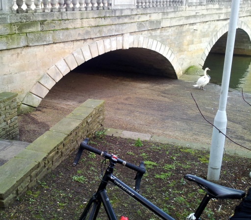
I started this ride in Bedford and joined the NCN by the A6 town bridge on the south bank of the River Ouse. This is convenient for the town centre, although the centre itself has little dedicated cycling infrastructure. I headed east on the NCN, but if you want to head west you need to cross the A6. You can go underneath the bridge, but you’ll need to be either small, flexible or on a recumbent, as the archway is too low for most users. Cyclists and pedestrians must therefore cross the A6, a busy four lane road lacking any crossing facility. If I am honest, this reinforced my expectations that NCN infrastructure is often just a bit crap.
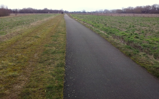
Heading west you are on traffic free shared use paths. The route has street lighting and the tarmaced surface is smooth and in good repair. The shared use path is wide enough for cyclists and pedestrians to pass comfortably, although you’ll need to be vigilant of dogs off the lead. As always, the shared use path could be improved by segregation.
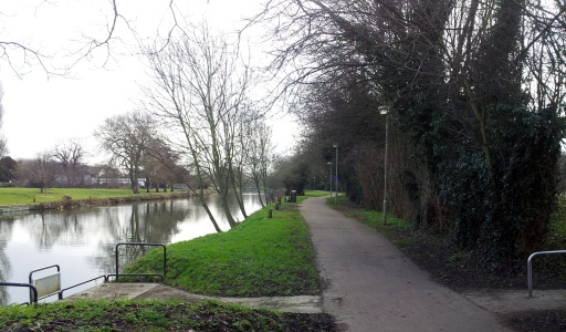
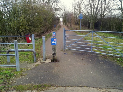
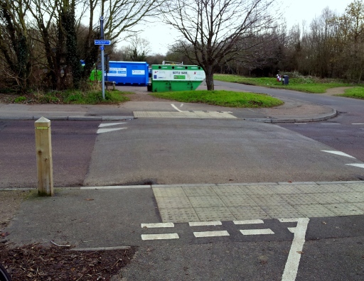
It is a pretty route passing through parkland alongside the River Ouse and Priory Country Park, so you hardly notice the transition from urban Bedford into rural Bedfordshire. The surface continues to be good and tarmaced. The one road crossing is sensitively designed with the road surface raised to the cycle path. However, at the crossings with other paths and farm tracks there are elaborate gate and chicane systems. They are inconvenient, but all appeared to be navigable with panniers or a child trailer.
After Priory Park, the A421 is crossed by a purpose built bridge. Indeed, whereas the path through Bedford and the country park appears to be improved existing infrastructure, this section looks and feels like a purpose built cycle path.
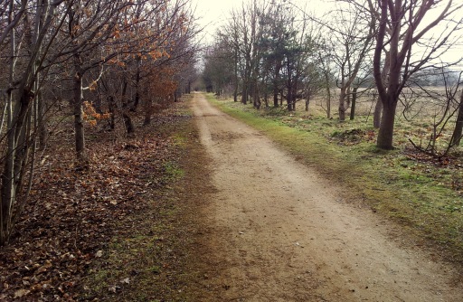
Entering Willington Woods the surface changes to crushed and compacted limestone. No doubt this was a deliberate decision to make the path in keeping with the woodland surroundings. However, it is a surface I don’t like and an argument I disagree with. As a surface, it can be slippery when wet, it does not wear well and is rough to ride on. Loose stones increase puncture risk and, if used regularly, the grit accelerates wear on the drivetrain and brake pads. The aesthetic argument is, I think, invalid. If there is genuine concern about the visual impact of a small cycle path blending into a Bedfordshire woodland, you would imagine there would be a concerted effort to convert roads through our National Parks to natural materials, or at least camouflage them.
Once out of the woods the tarmaced surface resumes, however, I noticed several places where shallow tree roots traversing the path, had lifted the surface into steep and narrow humps 3-5 cm high. These could easily bring down a rider at moderate speed (not an unrealistic expectation given the quietness of the route) and had to be taken with caution.
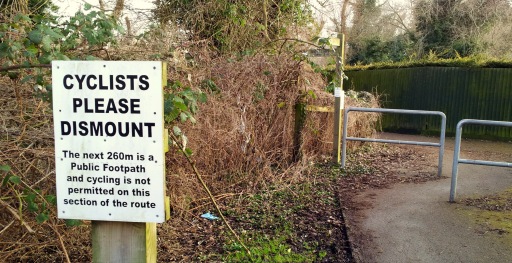
After Willington there is a 260m section that is footpath only. It is narrow and has two blind bends. It is a frustrating and disappointing interruption to another wise continuous 5.5 miles of traffic free cycle path.
After the footpath the tarmaced surface resumes, only now it is narrower, no more than a metre wide and, although it has no potholes, the surface is rough and uneven; not especially comfortable if you’re on skinny tyres.
The rough tarmac surface continues until you reach an underpass at Barford Road, connecting Willington to Great Barford. Here you take the left path to St Neots. Straight on takes you to Sandy and from what I could see of it, the Sandy path looked to be good quality and purpose built.
To follow the St Neots route you have to cross over the road you have just ridden under. There is a sign warning you the road is busy. It is not, it is very quiet and marks the start of the on the road section to Great Barford.
You enter Great Barford by crossing a narrow medieval bridge with traffic lights used to control the flow. Immediately after the bridge is a right turn, on to New Road, which takes you to the Roxton Road and the NCN. It is a quiet road and the lights mean the right turn is protected from oncoming traffic. The NCN does not follow this route to the Roxton road, instead it takes you further into the village, turning right just after a bend with poor forward vision. The signage comes late and is easy to miss (it was the only place I felt the signage to be inadequate). Given the position of the right turn relative to the bend and that you must be aware of oncoming traffic, this arguably a less safe turn.
Once on the Roxton road Sustrans instructs you to follow a path alongside the road. The path is narrow and frequently rough and uneven; you are better off using the road. The Roxton road was once a main route into Bedford, but has since been by-passed by the A421. So, today it is a broad, well surfaced and quiet local road.
From Roxton the route follows quiet country roads to St Neots and the town’s own cycle network. The road surfaces are generally good, although like most roads it has its share of potholes, otherwise there is not much more to add. Well not quite. Looking at the Sustrans route map, there is a proposal to take the route through Wyboston, then run alongside the A1 and use the A428 flyover to take you into St Neots. Although the proposed route is slightly more direct, I’m not sure I see the benefit. First it would take the route from a pleasant country road to the noisy A1 and some busy crossings. Second, new infrastructure would need to be built. For example there is currently no path on the A428 flyover. If Sustrans have the money, locally, I think they would be better off using it to improve the off road section between St Neots and Grafham Water turning it from an mtb trail into a usable cycle path.
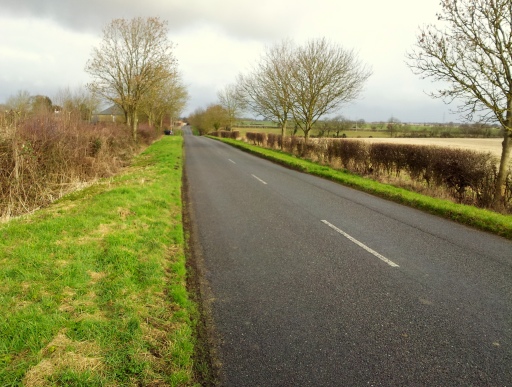
A quiet Bedfordshire to take you to St Neots, but in the future, you may be able to ride alongside the A1 instead
Overall I was pleasantly surprised by the off-road sections, they were generally well surfaced and while some were narrow and rough, they were not the potholed mud and gravel tracks found to the north of St Neots. So, compared to what I am used to, the ride was a revelation, but perhaps that is also a reflection on our low expectations of cycling infrastructure in the UK. Show this route to a Dutch cyclist and I can’t help wondering: would they see the work of well-intentioned amateurs or disjointed and naive planning authorities?

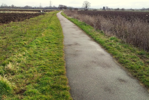
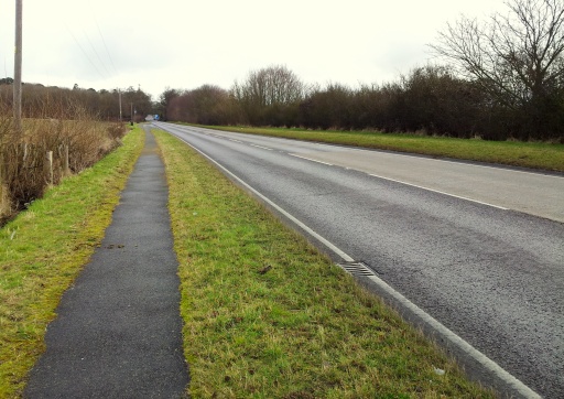
The section over to Sandy is very much the same as the area around Willington, very bumpy from rising tree roots and alternating between tarmac and compacted limestone. Couldnt get up to any decent sort of speed.
LikeLike
Glad you made the journey. this is often my route to and from work.
In Gt Barford NCN 12 (51) is currently routed along Addingtons Road in preference to New Road as it was considered that the junction of New Road and the A428 is more challenging if crossing over to use the shared cycle way on the payment. There being no dropped kerb in place and the speed that motor vehicles travel up and down the hill on the A428. The current signage has been placed by volunteer rangers and they are restricted in where their signs are permissible. Although vision is more restricted at the Addingtons Road junction in Gt Barford it is a 30 mph zone. As opposed to the 60 mph (but much higher speeds) at the New Road – A428 junction. Hope this provides some background. From the volunteer ranger who helped set the route and put the signs up.
LikeLike
It’s good that the bridge at Great Barford is traffic control but I’ve noticed two things.
1) If you’re not quick heading NW over the river the lights change on you (I spotted this with a group coming towards me over the bridge so point 2 didn’t happen)
2) I’ve seen too many people not see any cars coming and just run the red going SE across the bridge – happened to me on Saturday, got verbal from the Land Rover driver coming towards me so checked the lights and they were JUST changing to amber, cars behind him had moved up and waited
They seriously need to be on a longer cycle I feel given it’s an NCN route, I believe they calculate these and roadworks traffic lights as “20mph” to allow for bikes. Which is a bit quick for most casual bike riders out there I think!
LikeLike
I can’t believe there is a proposal to use the A428 flyover as part of the NCN.
I consider myself as a confident cyclist and in the few the few times I have used this section I think it is completely unsuitable.
If sustrans are trying to get people on bikes proper infrastructure is the best way forward as ,to be honest and someone that uses the NCN to commute to work ,some current path ways are not fit for purpose.
The general public are a little bit wiser on what they get when shopping for a bike theses days.
A few years ago the humble mountain bike was really all people ever bought but with the explosion in the hybrid/city/road bike ,which are much more suitable for people’s needs,this is now not the case.
Unfortunately you take one of these bikes on your average NCN route like Richard has described above it can be a miserable if not dangerous experience and could discourage and not encourage people out of their cars.
LikeLike
hi Chris,
I’ve heard from the local Sustrans co-ordinator and they think the proposed route along the A1/A428 flyover is a mistake – if you go onto the Sustrans route map it disappears as you zoom in. It is however, a route that they considered a couple of years ago, but have since dismissed. They would like less on road between Roxton and St Neots and open to ideas.
I agree entirely about poor surfaces putting people off. The section further north leading up to Grafham has sections which are difficult even on a mountain bike with 2″ wide knobbly tyres. On anything else it is unrideable.
LikeLike
They should continue the route out of the back of Sandy,
If you go through the housing estate at the Sandy end of the sustrans route. You can get on to the bridleway that runs along the rear of the train line. The bridleway then runs straight to the back of Abbotsley golf club.
I ride this route quite regularly and is rideable all year around.
With a bit of sensible path laying this would be a really sensible link and a great ride too
LikeLike
Richard M
interesting, live in Sandy, please elaborate, is this over the bridge of the old Bedford line ?
LikeLike
Hi Richard,
Sorry, I don’t know the route of the Old Bedford Line, so I don’t know. However, I wouldn’t be surprised if it is – cycle paths often make use of old rail infrastructure.
LikeLike
what I was asking is how do you get on the “bridleway that runs along the rear of the train line” as you stated which road leads to this please
LikeLike
The section on the National Cycle Network (NCN) is well signposted through Sandy from the Railway Station through to Bedford, St Neots and beyond. Just look for the blue, red and white signs 12 & 51. The NCN map may be viewed on the Sustrans website http://www.sustrans.org.uk
LikeLike
They should continue the route out of the back of Sandy,
If you go through the housing estate at the Sandy end of the sustrans route. You can get on to the bridleway that runs along the rear of the train line. The bridleway then runs straight to the back of Abbotsley golf club.
I ride this route quite regularly and is rideable all year around.
With a bit of sensible path laying this would be a really sensible link and a great ride
this is your article that I am intrigued by but dont know how to access from Sandy end, please elaborate as very interested
LikeLike
I also regularly ride this route. Sometimes find the northern section on the muddy side. — Speaking as a volunteer for Sustrans, rather than an official, I suspect this route has not been developed because of the numbers of land owners involved and the ever increasing desire the lay down metalled tracks for the NCN. Most of my involvement is in Cambridgeshire but will endeavour to make enquiries with those involved in Bedfordshire. Where most of this section is.
LikeLike